Friday, June 19, 2015

Matterhorn Campground, Telluride, CO


P1010630

After leaving Navajo National Monument we entered Colorado, where we were planning to hang around Cortez and Durango for awhile. With the heat we knew camping without hookups was not an option, so after stopping for gas in Cortez we continued north towards Telluride along Highway 145, part of the San Juan Skyway Scenic Byway. Jim made me stop to pick up a pie at the Dolores General Store, where they had one rhubarb pie left, which was as good as we remembered from a few years ago. It really is a beautiful drive with the snow covered San Juans visible along the climb to 10,000’ Lizard head Pass.

We had been this way in 2012 and stayed at Cayton Campground near the small town of Rico, but we were hoping to get a site at Sunshine Campground, just a few miles from Telluride. After driving over 200 miles we pulled in behind a trailer who was getting the last RV site. The camp host suggested we go back 4 miles to Matterhorn Campground, where we were lucky to get a nice open site. This forest service campground even has sites with full hookups and a couple were available but we didn’t need electric at over 9,000’ elevation. They also have very nice showers, water but no dump station. It was surprisingly warm, though, compared to when we were in this area in July when it was quite cold and rainy.

P1010622

The camp hosts told us about a trail just across from our site that intersected with a dirt road to Priest and Trout Lakes.

P1010611

P1010608

P1010609

P1010613

P1010616

Trout Lake. There are private cabins all around the lake.

P1010617

P1010618

We could only stay one night as we were in a reservation site with someone coming in the next day, but with a one o’clock check out we had plenty of time for another walk before we left. This time we detoured off the road and walked around smaller Priest Lake.

P1010628

P1010629

That’s our Lazy Daze in the center of this photo. A very nice spot.

P1010626

We would have stayed the 7 day limit if the site hadn’t been reserved, but the Telluride Bluegrass Festival is this weekend, which is apparently a really big deal, and everything was expected to be full for miles around. After months of playing tourist and doing way too much moving around, we needed a place to get some packages delivered and to do some projects we’ve been putting off, so I found us a site for a month in a part of Colorado we haven’t been to before, but I’ll save that for the next post. Sometimes we just need to stop and catch our breath.

Wednesday, June 17, 2015

From Page to Navajo National Monument


After leaving the North Rim, in the rain of course as a fitting ending to our week there, we headed toward Page, AZ  where we enjoyed staying on Lone Rock Beach a couple times previously. The drive was just beautiful. It seems we always forget how scenic this area is.

P1010564

P1010566

This time we knew we would need to run the air conditioner so we stopped at Page- Lake Powell Campground, which actually wasn’t a bad place to spend the night. I forgot to take photos, but we got a water and electric site for $23.97, and used their very nice and cheap laundry room, fitness center, which actually had some decent equipment, and showers. It was 97 in Page that afternoon so in the early evening we took a drive to the Glen Canyon Dam and Colorado River overlook, where we took a short walk.

P1010567

P1010569

P1010576

P1010577

The following day we headed off east to check out Navajo National Monument. I’ve read about it on a couple other blogs, including our friends Don and Dorothy, who said good things about it. We have a standing joke that if they like a place, we won’t, and vice versa, but we agree with them on this one. For a free place to spend the night and learn about the Ancestral Puebloans who inhabited the canyon cliffs it’s definitely worth the 9 mile drive off Highway 160. The 30 site campground has paved sites with maybe a half dozen that we would fit in and get relatively level, but it is better suited for tent and van camping. They offer drinking water, flush toilets, and trash cans. The sign at the turn off on 160 states RV length limit is 28’ but we had no trouble getting our 30’ around the loop, and I read a review from someone with a 35’ motorhome who stayed there. The trick is to arrive early in the afternoon before people start coming in for the night. And we had a few bars of 4G with the booster.

P1010590

At 7,300’ we were hoping for a little cooler weather, but it actually got into the mid 80s. We walked to the visitor center and looked at the exhibits, then took the trails to the Betatakin overlook and canyon view. The ancient peoples picked a lovely canyon to build their cliff dwellings, where they lived from 1250-1300. It is thought that drought may have contributed to their leaving, but food was left in the dwellings indicating they may have planned to return.

P1010587

The ruins in the alcoves across the canyon were barely visible with the naked eye.

P1010582

P1010586

P1010588

The park offers guided ranger hikes to the Betatakin ruins, but I couldn’t get myself moving to make the 5 mile round trip 8 AM hike. There was another more strenuous 3 mile hike at 10 but it was already so hot we decided against that, too. You can also hike down to the Keet Seel ruins for a 14 mile round trip hike. There’s a primitive campground down there so it doesn’t have to be done in one day but does require a permit and a ranger will meet you at the ruins for a tour. There must be a way to drive down.

P1010581

Our day ended with a beautiful sunset. This is a good place to spend a night or two if you’re traveling between Page and the Four Corners area.

P1010599

P1010592

Monday, June 15, 2015

Last Days at the North Rim


P1010500

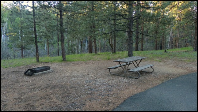
On Friday after lunch we moved a quarter mile to the North Rim campground, where we were lucky to have gotten a very nice pull-through site on the perimeter. For a national park campground it’s better than most we’ve been to, with large, fairly level, well-spaced sites. For $9 with Jim’s pass it was worth it to be so close to the rim. There is potable water and a dump station, and restrooms with flush toilets. Down the road a short distance is a building with a laundromat and pay showers, and the general store is just a short walk.

P1010562 

P1010561

It rained a bit as we were setting up, but it soon stopped so we went for a walk down the Bridle Path Trail to the visitor center, then continued on past the lodge to Bright Angel Point. This is just a short paved trail, 1/4 mile long, with 200 feet of elevation drop to the point, but it was probably our favorite as it affords such wonderful views along a narrow, steep ridge with Roaring Springs Canyon on one side and Transept Canyon on the other.

DSC01884

DSC01885

DSC01886

DSC01889

P1010501

P1010509

P1010494

We spent more time on Bright Angel Point than we thought we would, so we arrived back at the lodge a few minutes late for Gaelyn’s ranger talk about the California condor. She is a great story teller and teacher, and we really enjoyed learning about the efforts being made to save the condor from extinction. She had a large captive audience.

P1010517

After her talk, we walked over to the tavern and got a beer which we brought back to the lodge and sat on the porch watching the dark clouds over the canyon. Since we couldn’t see in that direction we didn’t realize another storm was brewing back towards the campground. Just as we were planning to take the 1.25 mile trail back it started raining, with thunder and lightning, which quickly turned into some serious hail.

P1010520

P1010523

We probably watched and waited for a good 45 minutes, with Jim even checking to see if we might be able to get a table at the restaurant for dinner, which of course we couldn’t. Finally he found an employee who said we could hitch a ride on the employee shuttle back to the campground, which we did. When these storms move in over the canyon they not only drop rain and hail, but the temperatures drop dramatically, too. We were happy to have gotten a ride back.

The next day we hiked the Widforss Trail, which skirts the Transept Canyon. There were dark clouds and thunder in the distance, and we couldn’t tell which way it was moving, so of course it moved right over us, pelting us with small hail for about 10 minutes. We started to turn back but it was letting up so we continued on to the halfway point on the trail at about 2.5 miles.

A frequent sighting, the Kaibab squirrel, which is only found on the North Rim.

P1010480

That white tail just doesn’t look like it belongs there.

P1010484

There was a warning sign at the trailhead about an aggressive grouse that has a nest near the trail. The park has put up pink tape around the area of the nest and asks people to go around the trail outside of the tape so as not to disturb her. We did as asked but when we were just about to get back to the trail we saw a guy who didn’t go around but continued down the trail. He warned us that the grouse was right there in front of him, and us, outside of the pink tape area. She would come charging at us as we walked towards her, and we hurriedly went around. It was pretty funny, and she was right there waiting for us when we came back.

P1010526

Trail views, before the storm.

P1010527

And after.

P1010529

P1010530

It took a minute to realize we were seeing the San Francisco Peaks and Mt. Humphreys near Flagstaff. The snow capped mountains almost look like clouds.

P1010535

Since the trailhead was on the road to Point Sublime, we decided to continue driving on the 17 mile dirt road with signs recommending high clearance and four wheel drive. Hey, we have an all wheel drive Subaru with relatively good ground clearance so how bad could it be. Turns out the road wasn’t too bad initially but due to all the rain it was muddy and rutted in spots. In fact we did some sliding around in the mud but made it through. After several miles we entered a lovely meadow where a truck was coming towards us. The driver stopped next to us and said we should probably turn around as the road got worse ahead. He said the last time he drove it he saw a Subaru with a punctured oil pan, so that was all we needed to hear. End of our off-roading adventures for the day, with a little mud to show for it.

P1010553

It rained more after we got back, but began to clear up late in the afternoon. Being our last day in the park I really wanted to see the canyon one last time, but Jim’s back was bothering him, so I drove to the North Kaibab trail, the only maintained trail on the North Rim that goes into the canyon, and went down to the Coconino Overlook, just a 3/4 mile hike. It was quite steep, and since this is where the mule rides go, also full of mule poop and mud from all the recent rain.

P1010552

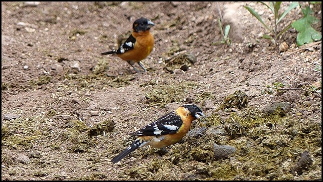
These black-headed grosbeaks were enjoying something in the mule droppings.
P1010551

I would love to go all the way down but just don’t think my knees could take it.

P1010543

Zoomed to show the trail snaking down into the canyon. I was alone on the entire hike back up.

P1010540

Still wanting more I walked out along the Transept Trail at sunset. Although nor really photo worthy, it was still beautiful.

P1010556

Crazy weather and all, the North Rim of the Grand Canyon definitely merits a visit. We understand why Gaelyn loves working there so much.